Wallkill River flooding threatens Black Dirt Region again
Warwick. The Wallkill Floodplain Bench Project has reduced flooding in certain areas, but some local farmers believe the project should be expanded.


The Wallkill River has been the source of historic flooding for decades, including the disastrous combination of Hurricane Irene and Tropical Storm Lee in 2011. It flows northeast through two states, from its source in Lake Mohawk in Sparta Township, New Jersey, to a point 27 miles later, where it enters New York near the northeastern edge of Warwick, joined by the Pochuck Creek, carrying waters from both Vernon and the Wawayanda Creek in Warwick, often resulting in the flooding of low-lying areas that include the Black Dirt agriculture region.
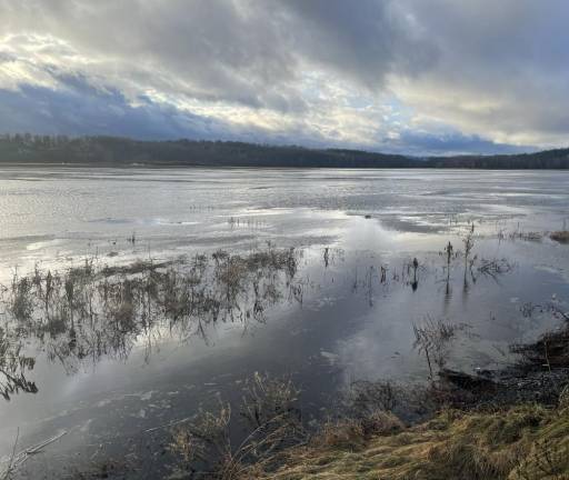
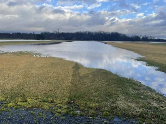
Recent snows and rainfalls have again raised the attention of both farmers and residents to the need to continue efforts to control the river’s volume as it swells beyond the riverbanks along its path toward Kingston. The area received over 30 inches from July to September. Dutchess, Orange, Putnam, Rockland, Ulster and Westchester counties received 29-33 inches of rain in the 120 days ending Sept. 30, according to NYS Mesonet, the state’s Early Warning Weather Detection System. On top of that a recent snowfall on January 6 dropped over a foot of snow onto Warwick and nearby region. Milder temperatures, however, melted most of the snow within 48 hours, while two subsequent rainstorms delivered several more inches of precipitation to an already rain-soaked soil.
“Fortunately when the soil is cold and the sod fields are dormant they normally survive being flooded. Soils don’t go dormant, however. Farm fields can absorb water until saturation point but all this rain has made it beyond that,” said Leonard DeBuck, a sod grower in Pine Island, whose property has been partially submerged in recent weeks. DeBuck believes that the Orange County Soil and Water Conservation District, which has spearheaded this effort, needs to expand the Wallkill Floodplain Bench Project that started in October 2016. At that time then-State Sen. Jen Metzger had secured a $400,000 grant for the third phase of the ongoing Wallkill Floodplain Bench Project to prevent flooding of farmland in the Black Dirt region. The bench actually lowers the riverbank, allowing high flows to escape to the bench which conveys the flood flows – keeping them off the adjacent fields. But the river’s rise continues to threaten sensitive farmland in Orange County.
More work to be done
In 2021 reports from local farmers and landowners combined with observations by Orange County Soil and Water Conservation District staff indicated that the work already completed from the Pochuck confluence to County Route 1, had provided enhanced flood protection to agricultural fields near the project. The currently proposed work would extend and enhance the protection provided by the first three phases of the floodplain bench project.
The proposed project, according to the joint application form in 2021, would involve “creating floodplain benches on both sides of the Wallkill River by excavating down to the approximate bankfull elevation...Throughout much of the proposed project area this will result in cuts of 3 to 5 feet. Removed soil will be used in two primary ways: 1) placement on adjacent agricultural fields to replenish topsoil and improve drainage characteristics; and 2) export from the floodplain for various uses such as the soil aggregate market or for general fill purposes.” The project’s Phase 1-3 began near the Merritts Island region of the Wallkill, where the river’s tributaries include Rutgers Creek and Black Walnut Creek.
”Black Walnut Island Channel is actually the original route of the Wallkill before the Cheechunk Canal was built in the 1930s. It now functions more like a drainage ditch, draining in two directions – back into the Pochuck to the south, and into Quaker Creek in the north,” revealed Kevin Sumner, Orange County Soil and Water Conservation district manager. Notably the project’s scope included a review of the potential impact upon any endangered species living in the affected area, as well as wetlands, but the determination concluded that the project could be safely conducted.
Evaluating what works
According to Sumner the second half of 2023 presented some highly unusual, if not unprecedented, wet conditions. “The flooding has, in my view, had more to do with repeated rainfall events on continuously saturated soils than with extreme single events. It is therefore difficult to compare recent flooding extents/severity to what would be happening without the measures that have been completed since 2016. But we still believe that the measures have reduced the levels and duration of flooding. Over the next several months, my office will be refining our Wallkill/Black Dirt flood mitigation plans for the next five years in consultation with our engineers and a local steering committee.”
“The timing of the flooding has been fortunate for many farms,” said Chris Pawelski, owner of Ornery Onion farm in Goshen, “because it did not happen during the growing season. Had this occurred during the spring we would be facing another serious loss.”
The Wallkill is fed by 69 tributaries and drains 382 square miles, nearly half of Orange County, as it flows for 40 miles before reaching Ulster County. Along its path lie 22 towns, villages, and cities drained wholly or partially into the Wallkill. In Ulster County, the river continues for 26 miles before merging with Rondout Creek before heading to the Hudson River. The total watershed takes up about 785 square miles of New York State alone. There are also at least 16 public access points, and the river is frequently used for boating and fishing.
According to the Watershed Alliance advocacy group, the Wallkill River has also experienced periods of documented harmful algae blooms (HABS).
Climate change and subsequent alterations in weather patterns have challenged many of the conservation activities which have been in progress in the Wallkill River Watershed for decades. Unpredictable precipitation levels have made historic measurements of flood levels nearly obsolete. The river requires sustained monitoring to balance the requirements of farmers, residents, and recreational activities.