Maps show frack waste routes, water and quarry sites


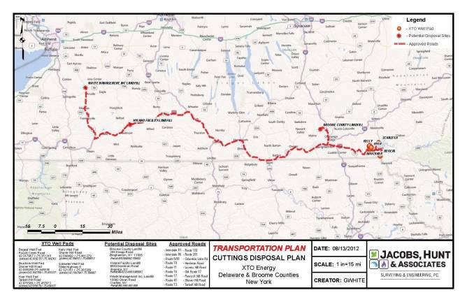
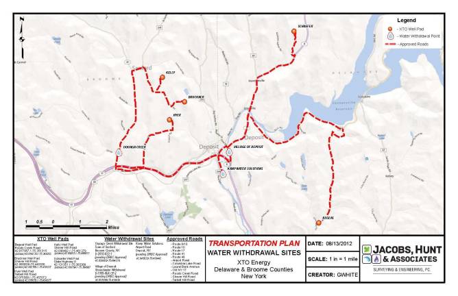
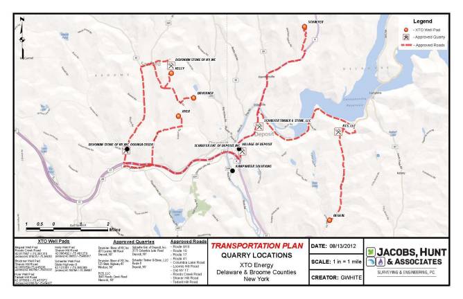
DAMASCUS — These maps from a permit application by XTO Energy, a subsidiary of ExxonMobil Corp., were made available by the Damascus Citizens for Sustainability to show transportation plans for fracking wastes across upstate New York and their proximity to New York's reservoirs.
The first map shows the path that radioactive drill cuttings will take across New York's southern tier. The cuttings, produced during well drilling in the Marcellus Shale and other deep shale formations, consist of the soil, rock particles, other soil like solids and drilling fluid residues generated from the drilling of wells.
According to a May 1 report on timeonline.com, which covers Beaver County and western Allegheny County in Pennsylvania, a truckload of drill cuttings from a gas well in Greene County left Pennsylvania because it was too radioactive for landfills in the state. The state Department of Environmental Protection will this month begin testing for radiation related to fracking, including trucks used in hauling and pumping wastewater.
The second map (click arrow to right of the map above) shows water withdrawal sites in Broome and Delaware counties in New York, and the third shows quarry sites.